Knocknagharoon Napoleonic Signal Station


There are four Napoleonic Signal Stations around the coast of the Loop Head Military Trail and all are on the Atlantic coastline. From north to south they are situated on Mutton Island , Ballard cliffs, Knocknagharoon Hill and Loop Head. The Loop Head Napoleonic Signal Station links with the Napoleonic Signal Station that was situated on Kerry Head.
Since Theobald Wolfe Tone and the Society of United Irishmen attempted to rally France behind the Irish cause in the 1790s, Ireland was seen as a possible focus for the feared invasion, and led to the British Admiralty constructing the system of signal stations as observation posts, together with 50 Martello towers, each maintaining a garrison of troops, officers and heavy artillery. The principal purpose of the signal towers was to keep watch on the coasts and to rapidly send signals around the country if unrecognised shipping was seen. Each tower, therefore, had to be within sight of one or more of its neighbours in both directions. The average distance between towers was 13.5km, although in West Cork the towers at Brow Head and Mizen Head are only 3.8km apart. Ireland’s coastline is about 1,400km long, depending how you measure it.
Various combinations of flags and canvas ‘balls’ could be quickly assembled on the signal masts and, with the use of a code book (above) fairly complex messages might be circulated. Another vital piece of equipment, of course, was a high quality telescope. As the Navy had such essential apparatus – and the experienced personnel to use it – the Irish signal towers were largely manned by active or retired sailors.
The Signal Stations in Connacht and Ulster consisted of stout stone built towers with adjacent signal masts. Many of the sites were set within large rectangular enclosures defined by tall stone walls. In some cases smaller buildings were also constructed at the signal stations to provide additional space for storage or accommodation.
In Connacht and Ulster green squares indicate where the signal towers survive to their full height. Yellow squares indicate where considerable remains survive. Red squares indicate where only low ruins survive. Black squares indicate where no traces of a signal tower can now be seen.
The signal station locations in Munster and Leinster have been marked on the map using the same colour coding. Circular shapes show where standard signal stations were located. Diamond shapes show where the signal stations were part of more complex barracks sites. Star shapes indicate where the signal stations were located at Martello Towers or larger forts. Concentric circle symbols indicate where the signal stations were located at existing lighthouses
Knocknagharoon Napoleonic Signal Station
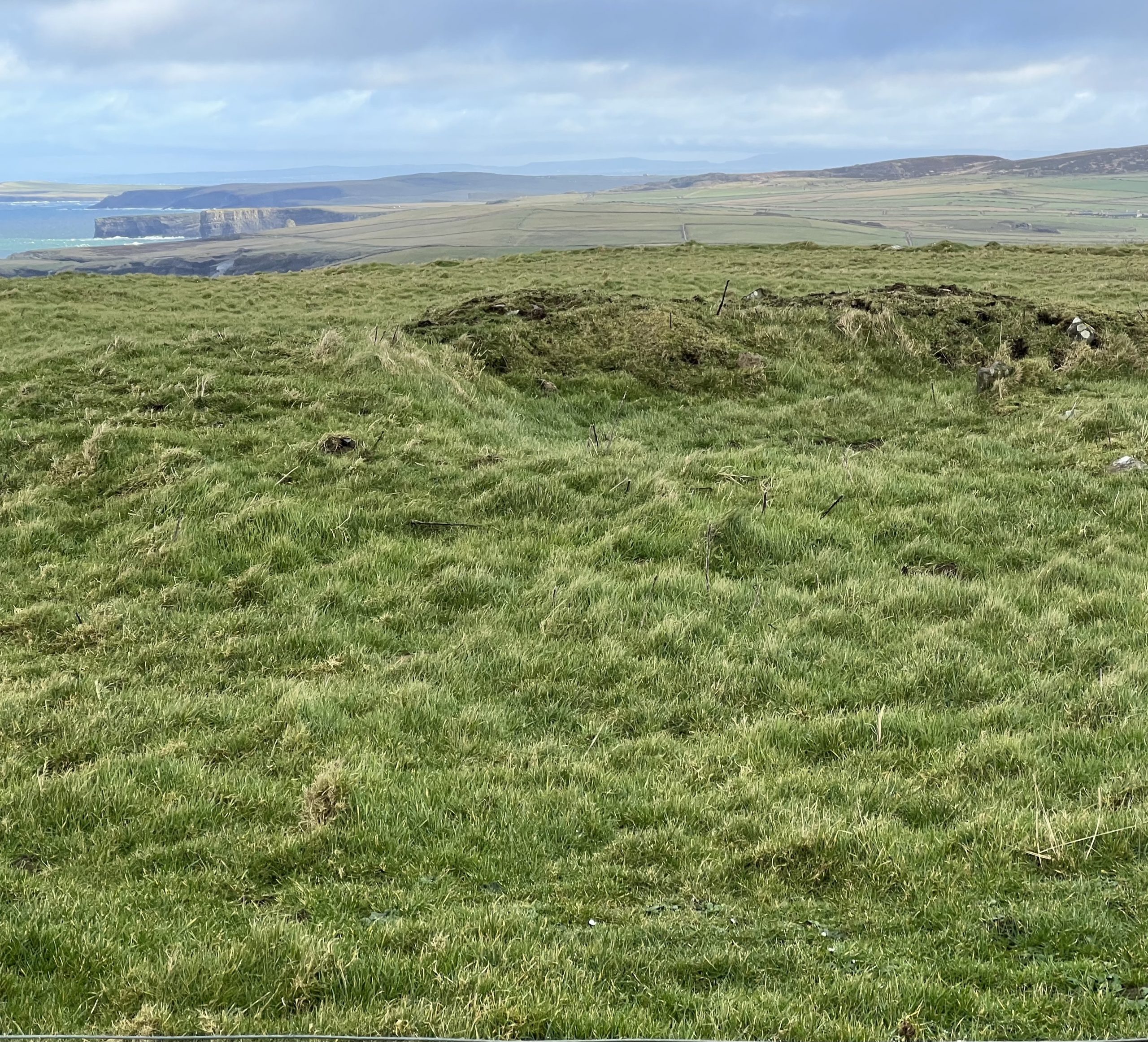
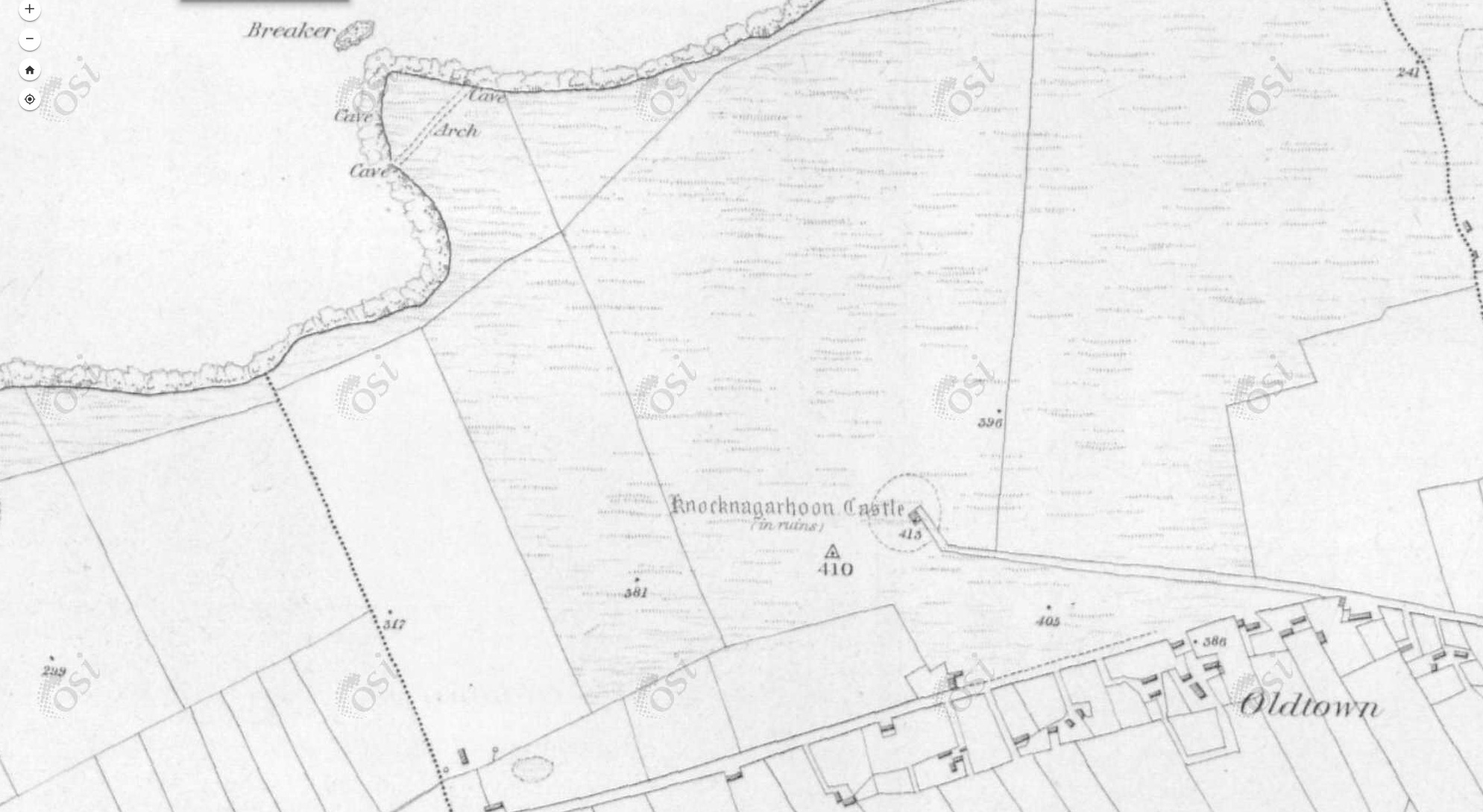
The unenclosed signal station at Knocknagharoon hill has been completely removed. The first edition Ordnance Survey map shows an unenclosed tower accessed via a lane that led right up to the tower.There is no pictures as yet of the old tower.Knocknagharoon Signal Tower was the link between Loop Head Signal Station and Baltard Signal Station.
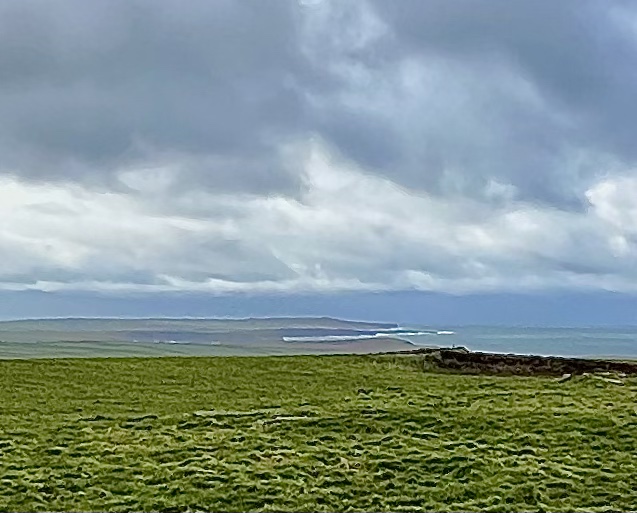
The 1st photo shows site of Knocknagharoon Napoleonic Signal Station on top of Knocknagharoon Hill. The 2nd photo shows the view north to Ballard Napoleonic Signal Station. The 3rd photo is the view south to Loop Head Napoleonic Signal Station as Loop Head Lighthouse is not in view.


No Comments
Add a comment about this page