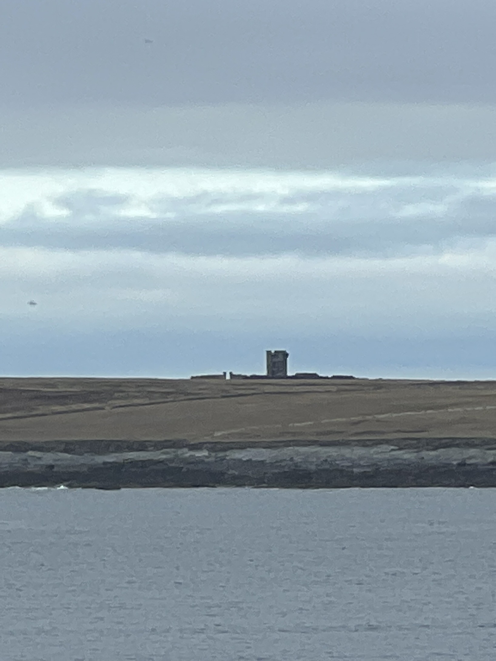
Mutton Island and its Napoleonic Signal Station.


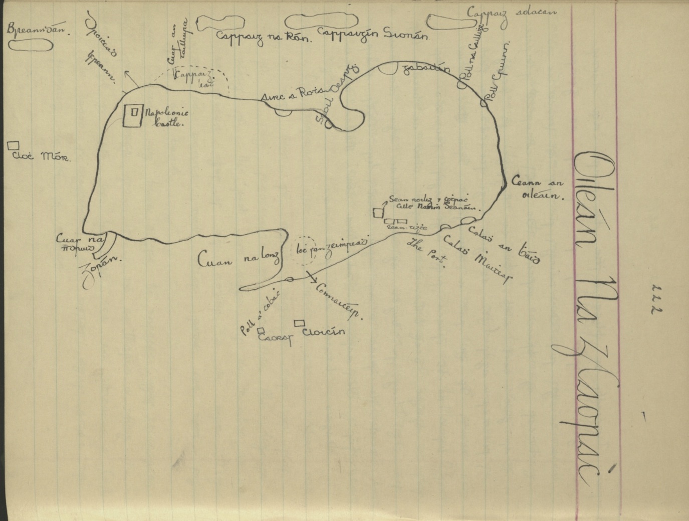
Map of Mutton Island with name places.Curtesy of ducas.ie. Michael de Blaca.
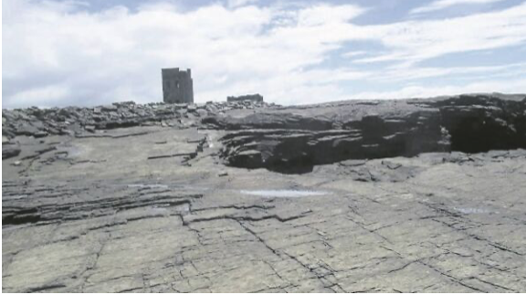
Napoleonic Signal Tower on Sandstone rock.
Location of the Napoleonic Signal Towers around Loop Head Military Trail.
There are four Napoleonic Signal Stations around the coast of the Loop Head Military Trail and all are on the Atlantic coastline. From north to south they are situated on Mutton Island , Ballard cliffs, Knocknagharoon Hill and Loop Head. The Loop Head Napoleonic Signal Station links with the Napoleonic Signal Station that was situated on Kerry Head and the Mutton Island Signal Station links with the Napoleonic Signal Station at Hags Head on the most southerly point of the Cliffs of Moher.
History of the Napoleonic Signal Towers.
Since Theobald Wolfe Tone and the Society of United Irishmen attempted to rally France behind the Irish cause in the 1790s, Ireland was seen as a possible focus for the feared invasion, and led to the British Admiralty constructing the system of signal stations as observation posts, together with 50 Martello towers, each maintaining a garrison of troops, officers and heavy artillery. The principal purpose of the signal towers was to keep watch on the coasts and to rapidly send signals around the country if unrecognised shipping was seen. Each tower, therefore, had to be within sight of one or more of its neighbours in both directions. The average distance between towers was 13.5km, although in West Cork the towers at Brow Head and Mizen Head are only 3.8km apart. Ireland’s coastline is about 1,400km long, depending how you measure it.
Various combinations of flags and canvas ‘balls’ could be quickly assembled on the signal masts and, with the use of a code book (above) fairly complex messages might be circulated. Another vital piece of equipment, of course, was a high quality telescope. As the Navy had such essential apparatus – and the experienced personnel to use it – the Irish signal towers were largely manned by active or retired sailors.
The Signal Stations in Connacht and Ulster consisted of stout stone built towers with adjacent signal masts. Many of the sites were set within large rectangular enclosures defined by tall stone walls. In some cases smaller buildings were also constructed at the signal stations to provide additional space for storage or accommodation.
In Connacht and Ulster green squares indicate where the signal towers survive to their full height. Yellow squares indicate where considerable remains survive. Red squares indicate where only low ruins survive. Black squares indicate where no traces of a signal tower can now be seen.
The signal station locations in Munster and Leinster have been marked on the map using the same colour coding. Circular shapes show where standard signal stations were located. Diamond shapes show where the signal stations were part of more complex barracks sites. Star shapes indicate where the signal stations were located at Martello Towers or larger forts. Concentric circle symbols indicate where the signal stations were located at existing lighthouses
Mutton Island Napoleonic Signal Station
The enclosed signal station on Mutton Island, County Clare, is well preserved and stands at the western end. It consists of a tall signal tower of the standard design which is complete up to its parapet level. The tower is set within a well preserved rectangular enclosure. The enclosure features an entrance on its short south eastern side and a rectangular building built against the western corner.
History of Mutton Island.
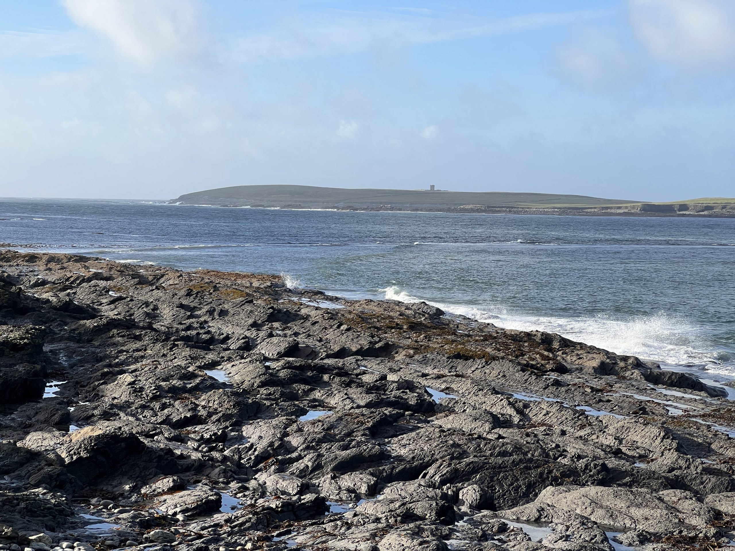
Oilean na g-Caorach ( Island of the Sheep) is the Irish name of Mutton Island.Also know as Iniskeeragh. The island extends to 185 acres and is 1.5 km from mainland.
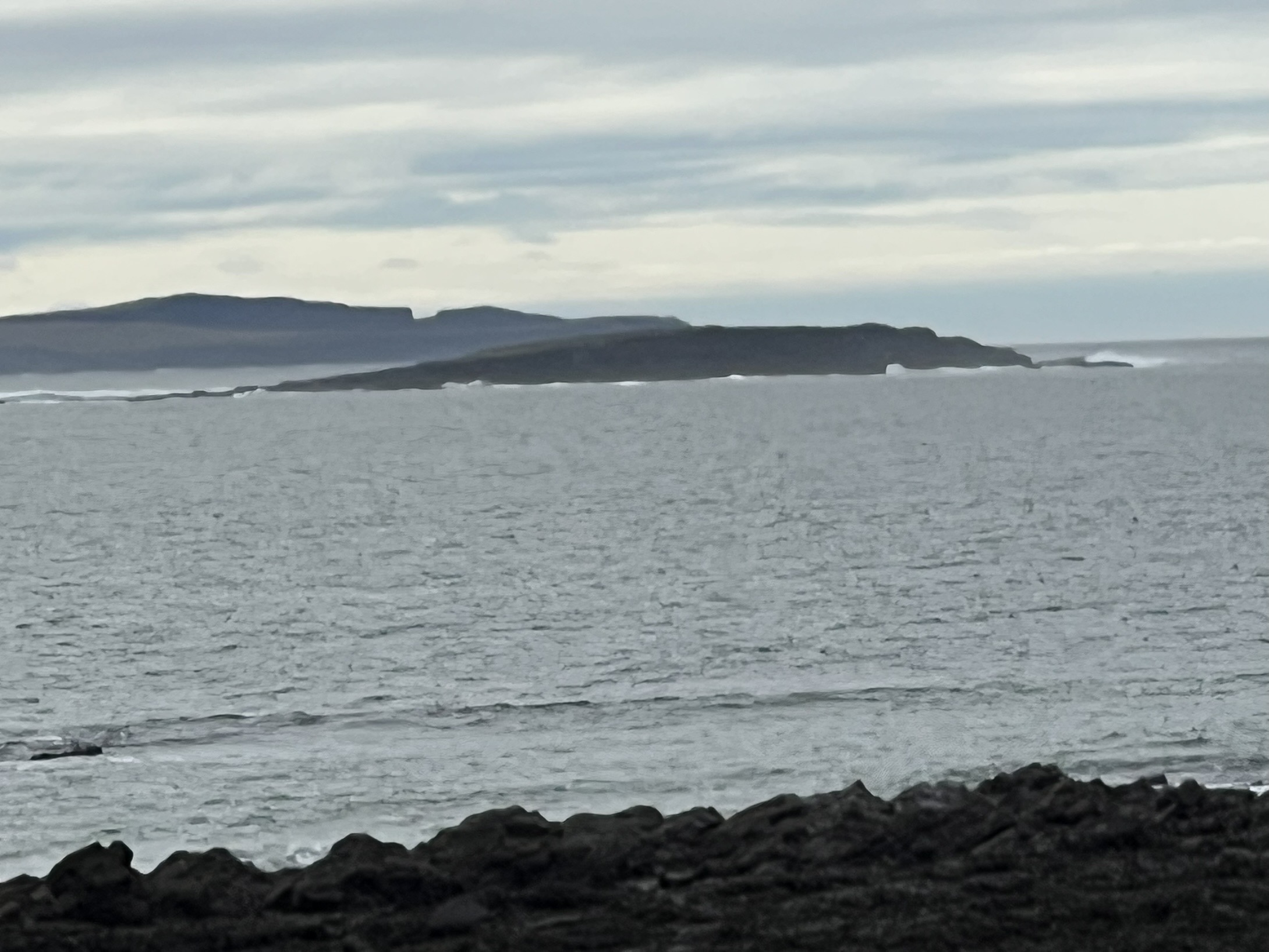
It was joined to the mainland at Seafield however in A.D.802 a tidal wave and perhaps an earthquake hit the land and some 2,000 persons perished. The sea washed away the neck of the land joining Mutton to the mainland. It was broken into three fragments , Mutton Island, the central island ; Mattle Island, and the reefs of Carrickaneeliwar and the Seal Rock. Mutton Island itself is nearly cut across by bays and tunnels.
St. Senan had a church here, and one course, late looking fragment of the west end stood in 1887 in a garden behind one of the houses. On the rising ground to the north and the north-east are found two small cairns and slabs partly cut to shape, perhaps fragments of a late rude cross.
There are many holes and caves and the drawing from the 1930s by Michael de Blaca in the Ducas collection show these and much more.
The Sao Marcos foundered in 1588 ,on the rocks off Mutton Island, part of the mighty fleet attempting to invade England.The 790-ton galleon carried 33 guns, 292 soldiers, and 117 sailors. Most drowned.There is Spanish Graveyard in the western side of the island however due to storms and erosion little of it is left. All survivors from this tragedy and the San Esteban further up the coast were hanged under the orders of the high sheriff of Clare, Boetius Clancy.
The shape of the island was a friend to the smuggler for centuries and provided numerous deep caves for hiding contraband, mainly wine.High taxes meant that intrepid importers used the deep caves to hoard their goods and thereby avoid the punitive duties payable to the government on landing.
A large gull colony provides a cacophonous welcome to any visitor in the nesting season — April to July. It is only one of a handful of islands on the Atlantic coast of Clare. Nearby Mattle Island and Carrickaneelwar are just reefs really.
The island was inhabited up to the 1920’s but little remains of the village today. It is believed to have been home to twelve families in the nineteenth century. Names such as Gallagher, Kelleher, Griffin, Scully, Power, Boyle and Egan were associated with the place. They made a living partly from fishing. They also harvested kelp, dilisk and carrageen. Potatoes and vegetables were grown and they kept some domestic animals. The island, as its name suggests, had a long tradition of sheep farming. They also cut turf and hay was saved. Much of the island is good grassland, some is rough pasturage. A lake on the island covers an area of three to four acres.
Ownership of Mutton Island was in the hands of the Archbishop of Cashel in 1215. He was granted it by Donchadh Caibbreach O’Brien, though it later passed back to the O’Briens, then Earls of Thomond. William Stackpoole (1743-1796) was the agent and he sold his interest in the place to a Mr. McDonough. It was later owned by Mr. Griffin, an Ennis victualler. He sold it to the Casey family from Mullagh, who in turn sold it to Mr. Hafa, an American. In recent years it was bought by Pat Egan from Liscannor. Today, Mutton Island is inhabited only by wild goats, seals, rats, rabbits and birds.
T.J. Westropp, the antiquarian and surveyor, visited the island several times. In more recent times Eamon De Buitlear, an environmentalist, has spent some time here. Dick Warner from R.T.E. included Mutton Island in his television documentary. The island is a quiet, unspoilt area of natural beauty, rich in history, geology, archaeology and botany.


Comments about this page
Thanks for this information, Mick.
According to admiralty records the mutton island tower cost €18000 in the early 1800s-a considerable sum of money
Add a comment about this page